Health & Fitness
Dispatch From Upper Falls - A Hidden Gem
Upper Falls' little known Charles River Path park alongside the Charles River is a hidden gem waiting to be discovered.


Upper Falls has one of the city's favorite and most well known pieces of park land - Hemlock Gorge, with its waterfalls, woods, island and of course the iconic Echo Bridge spanning above the whole thing.
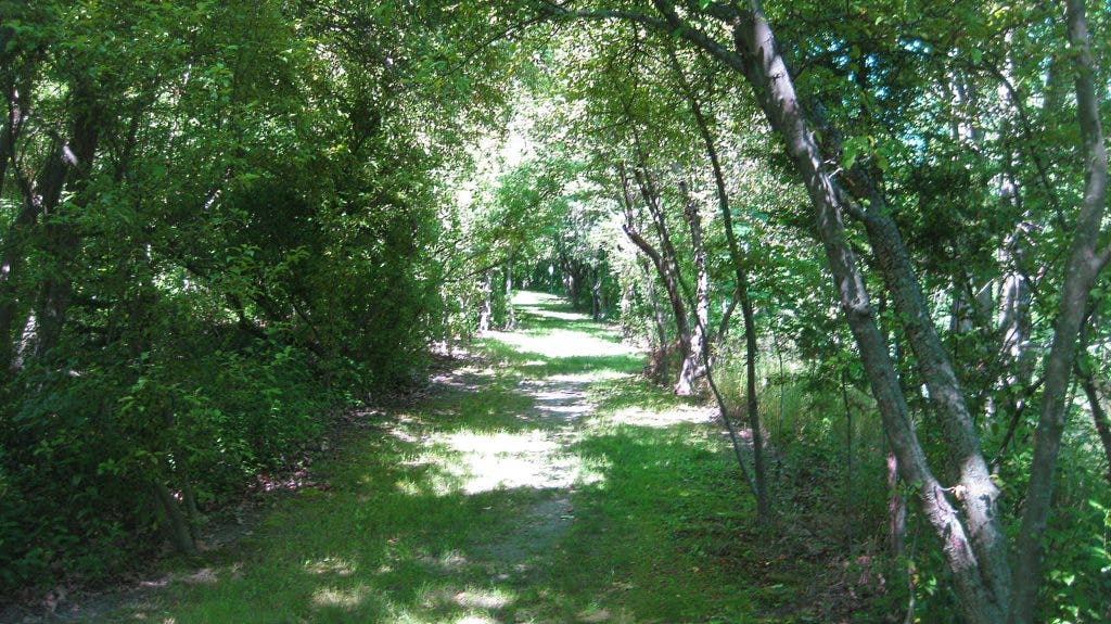
Less than a mile upstream, Upper Falls has another park that's one of the best kept secrets in Newton. The Charles River Path is a roughly 1/3 mile long stretch of lovely river front park land owned by the city of Newton. The park is so unknown that even many local residents, who have lived nearby for years, have no idea it exists.
The park is accessible from Oak Street. Turn down either Saco or William Street, go to the end and you'll see a footpath that leads down to the river. Once there, you'll find a very pleasant park with various lookouts on to the river. The reason the park is so underused is that it's an "island". It's not big enough to be a destination on it's own and its not connected to any other park land or trails.
Find out what's happening in Newtonwith free, real-time updates from Patch.
Ironically, this isolated park was created as part of a plan to link the entire Charles River waterfront together with walking paths. Now, many years later, this isolated park exists but the connections to the rest of the riverfront were never followed through on.
The Charles River Pathway was an ambitious plan put together by the Newton Conservation Commission in 1975 to create one continuous system of walking trails that would extend from West Roxbury to Watertown Square along the banks of the Charles River. In the intervening years, the state's DCR (Department of Conservation and Recreation) has done a wonderful job of building the portion of the Charles River Pathway that was under their jurisdiction. You can now walk from Auburndale to Watertown Square on river front paths thanks to the DCR's hard work over many years. In the other direction, you can walk on DCR trails from Needham St to Millenium Park in West Roxbury
Find out what's happening in Newtonwith free, real-time updates from Patch.
Sadly, very little of the plan that was in the city's hands was ever built. Sadder still, is that it was the city's own Conservation Commission who created the plan in the first place. One of the few tangible results that you can see today of the city's work on the Pathway, is this isolated but very pleasant park in Upper Falls.
A few opportunities exist though for making some easy improvements and working toward the Conservation Commission's dream of connecting the entire river front together with foot paths.
*One end of this park ends at the base of a steep railroad abuttment. That railroad line is the path of the future Upper Falls Greenway bike trail/walking path. It would be a simple matter to build a set of stairs down the embankment to connect the Greenway to the Charles River Path for walkers.
* On the other side of the railroad embankment there's about a 1/4 mile of land owned by American Towers between the railroad and Braceland Park. The city already has an easement across this property that was acquired for just this purpose many years ago. With a simple gate at the back of Braceland Park and a bit of pruning of the very rough trail that's already there, we could have a trail for walkers that connects Braceland Park to the Greenway and the Charles River Path park.
* To get from one side of the railroad tracks to the other, you need to climb up and down the steep embankment. There was an interesting alternative proposed in that 1975 plan. The railroad tracks cross over the river on a bridge. Under the bridge, there's a narrow (maybe three foot wide) concrete ledge. By adding a railing to that ledge and doing a bit of trail work, a simple pedestrian connection could be made under the bridge.
Over the last thirty years or so, the DCR slowly and incrementally put together their portion of the Newton Conservation Commission's Charles River Pathway. Those DCR trails are now some of the most popular and valued park lands in Newton. It's time now for the city to dust off that old plan and start stitching together the river side trails on its own properties. With a few simple foot path connections, the underused and nearly unknown Charles River Footpath park in Upper Falls is waiting to be discovered.